Reclaiming Hong Kong: A history of the changing coastline
By Roberliza
Feb 16, 2022
“Reclamation is unavoidable”, Hong Kong Chief Executive Carrie Lam told journalists on a land supply discussion in 2019. “In the long term, many developing cities have to adopt this choice.”
Like many places in Asia, Hong Kong has been defined by reclamation – edging further into the sea has turned 733km of jagged shoreline into a global metropolis housing 7.4 million people. About 6% of the city is built on reclaimed land, and while that sounds modest, it translates to 7,000 hectares of land, or half the size of Lantau island. Today, one in every three Hong Kong citizen lives on reclaimed land.
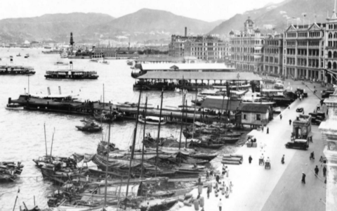
Tsim Sha Tsui Star Ferry Pier before
Tsim Sha Tsui Star Ferry Pier after
In land reclamation, everybody wins – the space-starved locals, the housing crunch – well, except the environment, marine life and the fishermen who depend on it. Land reclamation has completely transformed Hong Kong’s iconic coastline, with changes so drastic the older generation can now barely recognise the city from their youth. If that has piqued your interest, let’s time-travel back to the sleepy fishing village Hong Kong once was, but carry a life jacket – chances are that the land you’re standing on now didn’t exist back then…
Built to the Hilt
Des Voeux Road before
Des Voeux Road after
Almost as soon as the British arrived in 1841, they began to push the shoreline further into the sea until it reached current-day Des Voeux Road. Queen’s Road was the coastal edge leading towards Wan Chai, then known as Praya East. Hennessey Road was the land’s periphery. Gazing across the Victoria Harbour was a completely different experience – the chunk of sea was twice its size.
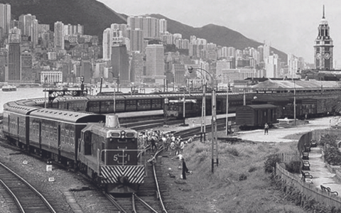
When the iconic ‘ding ding’ was built 118 years ago, it marked the coast of Hong Kong Island. Up until the 70s, the now bustling towns of Shatin, Tuen Mun, Ma On Shan and Tung Chung were peaceful, quiet hills. Tai Po and Tseung Kwan O were also yet to be carved from sea and swamp.
The first real attempt of land reclamation occurred in December 1851 after a massive fire wiped out the Sheung Wan district. Clearing the rubble would’ve costed the British government an enormous budget, instead they shifted debris into the sea, extending the shoreline by 50 feet. An ambitious project for the era, it finished in 1859 and resulted in Queen’s Road Central and Bonham Strand we know today.
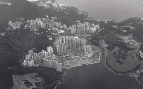
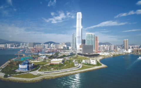
Over the next century, a series of rigorous reclamation projects made way for two airports, first at Kai Tak and then the 1998 world-class upgrade at Chek Lap Kok. Nearly 250 million cubic metres of raw materials were rummaged to fill up 1,248 hectares of land in less than three years. During the late ’90s, legislators also signed off on creating 340 hectares of reclaimed land to redesign the Kowloon waterfront, carving out space for big-ticket projects like the West Kowloon Cultural District and the Express Rail Link. Just as this was taking shape, there were proposals to fill in the whole of Kowloon Bay.
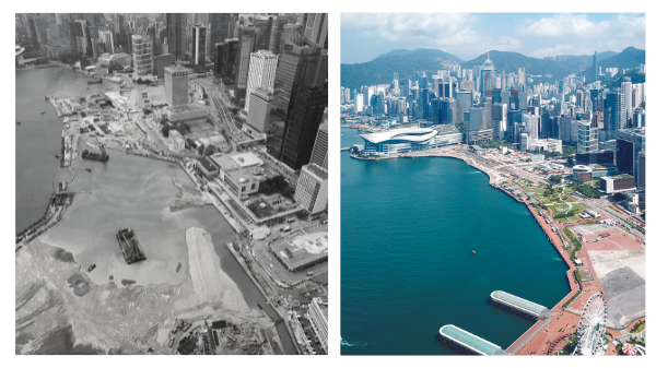
Money into the Sea
Victoria Harbour before and after
In Hong Kong, the ground under your feet is never quite as firm as it seems and with so much concrete being poured into the sea, a looming threat was that one day the entire Victoria Harbour might completely disappear. With the gap between Central and Tsim Sha Tsui less than a kilometre wide, and already resembling a river rather than a sea channel, activist Winston Chu and legislator Christine Loh teamed up to push through the Protection of the Harbour Ordinance in 1997. Upheld in the Court of Final Appeal in 2003, the legislation prohibited any further reclamation of Victoria Harbour “unless there is an overriding public need”.
“In Hong Kong, the ground under your feet is never quite as firm as it seems… a looming threat was that one day the entire Victoria Harbour might disappear”
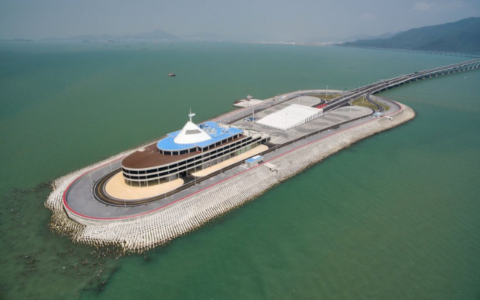
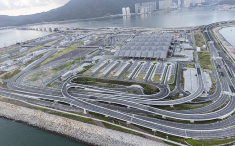
Hong Kong-Zhuhai-Macau bridge construction
In one of the most remarkable feats of modern engineering, the world’s longest sea crossing, the 55km Hong Kong-Zhuhai-Macau Bridge, was constructed to provide a critical link between the three key Chinese cities. Built with 400,000 tonnes of steel, it is the biggest international landmark of reclamation – spanning 22.9km over the sea and 6.7km underwater.
Opened to public in 2018, the bridge came at a cost, and not just its price tag of US$26 billion. No less than a million tonnes of concrete were dumped into the sea, which shook the habitat of the endangered pink dolphin. Disturbing images of dolphins washed up on shore emerged as their population fell by 60-percent.
Hong Kong-Zhuhai-Macau bridge before
Hong Kong-Zhuhai-Macau bridge after
Turning sea into viable land is a high-risk operation. Reports are widely circulating about Dubai’s manmade archipelago, Palm Jumeirah, sinking into the sea. Reclaimed land becomes a huge risk during an earthquake. Persistent shaking can initiate a process called soil liquefaction, where waterlogged sediment that was once solid begins to liquefy. The 1906 San Francisco earthquake is an alarming case in point.
Yet, the need for humans to encroach beyond their natural shores remains. The housing crisis in Hong Kong has deepened; it is estimated that over the next 30 years the city will need an additional 9,000 hectares of land to support its growing population. It’s a precarious balancing act, and no-one knows when and how this land grab will end. A few decades from now, will we be able to recognise the Hong Kong of our youth?